Red maples: when half the leaves turn, by latitude, 2016–2025
At 45.5° N in Wisconsin, a typical red maple was half turned by September 18; at 32.5° N in Alabama, not until November 22, 65 days later.
What does this axis measure?
Half the leaves turned (day of year)
What does this axis measure?
Latitude (degrees north)
Reveal the axesHide the axes
- y ↑
- Half the leaves turned (day of year)
- x →
- Latitude (degrees north)
Show the story, the data and the sourceHide the story, the data and the source
The data: 26 points
| Latitude (degrees north) | Half the leaves turned (day of year) |
|---|---|
| 29.79 | 289 |
| 30.32 | 317 |
| 32.54 | 326 |
| 35.46 | 313 |
| 35.69 | 310 |
| 36.21 | 302 |
| 36.62 | 300 |
| 37.38 | 282 |
| 37.57 | 307 |
| 38.35 | 306 |
| 38.95 | 318 |
| 39.12 | 293 |
| 40.16 | 299 |
| 40.86 | 298 |
| 41.26 | 284 |
| 41.75 | 281 |
| 42.37 | 292 |
| 42.54 | 287 |
| 43.01 | 272 |
| 43.69 | 283 |
| 44.07 | 276 |
| 44.9 | 301 |
| 45.49 | 272 |
| 45.5 | 261 |
| 46.23 | 275 |
| 47.14 | 264 |
- Ran in puzzle #42 on November 7, 2026. Play it
More like this
-
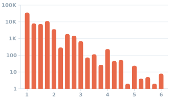 US reports of severe hail by the size of the hailstones, 2016–2025
Hail reports (count) ↑
Hailstone size (inches) →
-
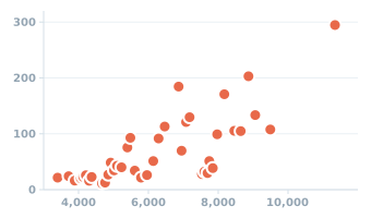 Colorado weather stations: elevation and normal yearly snowfall, 1991–2020
Yearly snowfall (inches) ↑
Elevation (feet) →
-
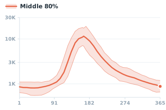 Yellowstone River at Corwin Springs, Montana: median flow by day of the year
River flow (cubic feet per second) ↑
Day of year →
-
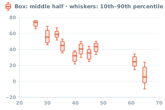 Halloween low temperatures by latitude in 10 U.S. cities, 1996–2025
Day's low (°F) ↑
Latitude (°N) →
-
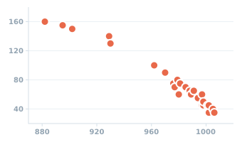 Atlantic tropical and subtropical storms of 2005: peak wind and lowest pressure
Peak wind (knots) ↑
Lowest pressure (millibars) →
-
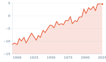 Sea level at The Battery, the southern tip of Manhattan, 1893–2025
Sea level (inches vs 1983–2001 average) ↑
Year →