Capitals of 40 populous countries, by latitude and elevation
Of these 40 capitals, only 3 sit above 2,000 m, and all lie within 25° of the equator: Bogotá is the highest at 2,582 m. Farther out, none tops Kabul's 1,790 m. Kampala sits 0.3° from the equator.
What does this axis measure?
Elevation (m)
What does this axis measure?
Distance from the equator (°)
Reveal the axesHide the axes
- y ↑
- Elevation (m)
- x →
- Distance from the equator (°)
Show the story, the data and the sourceHide the story, the data and the source
The data: 40 points
| Distance from the equator (°) | Elevation (m) |
|---|---|
| 0.3 | 1190 |
| 1.3 | 1661 |
| 4.3 | 240 |
| 4.6 | 2582 |
| 6.2 | 91 |
| 6.2 | 1120 |
| 9 | 2355 |
| 9.1 | 360 |
| 13.8 | 2 |
| 14.6 | 9 |
| 15.6 | 382 |
| 15.8 | 1171 |
| 19.4 | 2240 |
| 19.7 | 115 |
| 21 | 16 |
| 23.7 | 4 |
| 25.7 | 1332 |
| 28.6 | 216 |
| 30 | 23 |
| 33.3 | 34 |
| 33.7 | 490 |
| 34 | 87 |
| 34.5 | 1790 |
| 34.6 | 25 |
| 35.7 | 6 |
| 35.7 | 1179 |
| 36.8 | 0 |
| 37.6 | 38 |
| 38.9 | 72 |
| 39.9 | 43 |
| 39.9 | 938 |
| 40.4 | 663 |
| 41.9 | 21 |
| 45.4 | 70 |
| 48.9 | 48 |
| 50.5 | 179 |
| 51.5 | 4 |
| 52.2 | 118 |
| 52.5 | 34 |
| 55.8 | 156 |
- Ran in puzzle #28 on October 24, 2026. Play it
More like this
-
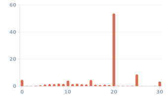 Tips on card-paid New York yellow-cab rides with fares of $5 or more, March 2023
Card trips (%) ↑
Tip (% of bill) →
-
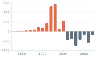 Detroit: population change from one census to the next, 1830–2020
Population change (thousands) ↑
Year →
-
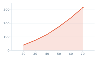 Typical distance a car needs to stop, by speed (UK Highway Code)
Stopping distance (feet) ↑
Speed (mph) →
-
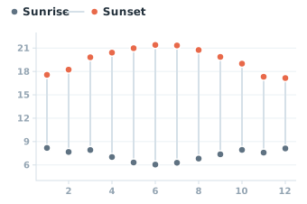 Sunrise and sunset in Grand Rapids, Michigan, on the 15th of each month, 2026
Clock time (hour) ↑
Month →
-
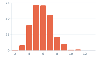 First names in the 2020 U.S. Census: people by the letters in their name
People with such a name (millions) ↑
Letters in the first name (count) →
-
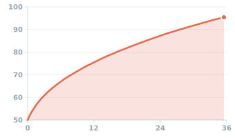 Median length of US baby boys, birth to 3 years
Length (cm) ↑
Age (months) →